When John Otto conceived the creation of what is now known as Colorado National Monument, he wanted visitors to be able to view the canyon how only the birds could see it. He was astounded by the otherworldly landscape he encountered, comparing it to a pocket-sized Grand Canyon.
Today, Colorado National Monument is mostly thought of as a scenic detour. There are options for hikers and campers who wish to spend more time here, but most of the experience comes from the 23-mile Rim Rock drive that connects Grand Junction and Fruita.
Along this picturesque stretch of road, expect to encounter a colorful array of rock islands, spires, pinnacles, and sheer canyon walls. Don’t be surprised to share the scenery with a wide variety of wildlife, including bighorn sheep, golden eagles, and mule deer.
In this guide, I will explain everything you need to know for your first visit to Colorado National Monument. This includes the best stops, vistas, things to do, photography tips, and more.
🧐 Quick Facts About Colorado National Monument
- Location: Colorado, USA
- Established: May 24, 1911
- Size: 20,500 acres (32.0 sq mi; 83 km2)
- Annual Visitors: 435,625 (2020)
- Visitor Centers: Saddlehorn Visitor Center (year-round)
- Entrance Fee: $25 per vehicle; $20 per motorcycle; $15 per individual; $80 Interagency Annual Pass
📸 Every Viewpoint in Colorado National Monument
The most popular way to explore Colorado National Monument is by driving the 23-mile (37km) Rim Rock Drive.
This scenic road takes you past 18 named overlooks (including the Visitor Center) and a few more pull-offs from which you can take in the area’s beauty.
While there are also multiple hikes you can take, most of the top sights in Colorado NM can be seen from the roadside.
1. Redlands Viewpoint

Starting at the west (Fruita) entrance of the park, you will begin the climb into Colorado National Monument and traverse a sharp turn before reaching your first viewpoint; Redlands View.
At the viewpoint, you are standing on Redlands Fault, a major break in the earth’s crust, and overlooking an area that was formed by seismic activity 40-70 million years ago and subsequent erosion by water flow.
Today, very small earthquakes still occur occasionally. They are actively monitored by Colorado National Monument in partnership with the Mesa State College Center for Earthquake Research and Information Center.
2. Balanced Rock Viewpoint

Your next stop along Rim Rock Drive will be Balanced Rock View.
Balanced Rock provides a great example of how erosion has shaped the landscape in Colorado NM, as well as much of the surrounding area. Once part of the canyon wall, Balanced Rock is now perched on its own pedestal seemingly defying gravity!
The boulder, which is about 600 tons, has been left isolated as most of the surrounding rock was been carved away by wind, water and chemical erosion.
3. Historic Trails Viewpoint

From Balanced Rock View you will head through two tunnels before reaching Historic Trails View. Make sure you keep a look out to your left for beautiful views of the road snaking up from Fruita.
As the name suggests, Historic Trails View provides a glimpse into the history of Colorado National Monument.
From the viewpoint, you can see the Fruita Dugway which was built in 1907 to allow construction of a water line to connect the Fruita Reservoirs to the town below. The road was built along a trail which has been used by ranchers to herd cattle between the valley and the mesa since the 1880s.

If you’re feeling energetic and adventurous, it is apparently possible to still hike this trail (although it is not an official trail within the park). At 3.8 miles (6.1km) each way with an elevation change of over 1200ft (366m), this is still a tough hike and one we were happy to skip!
Personally, I preferred to admire the views from the top anyway!
4. Distant Viewpoint
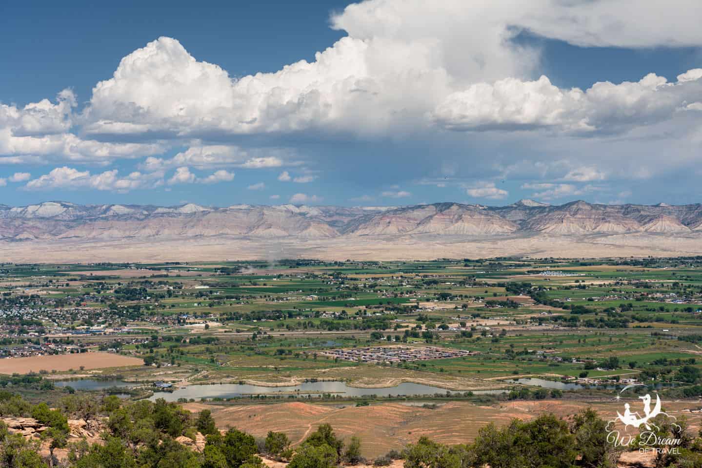
The next overlook, Distant View, provides an impressive vista that sweeps across the 30-mile (48km) Grand Valley towards the Book Cliffs, Roan Cliffs, and Grand Mesa. From above, you can see the Colorado River meandering across the valley floor and the town of Fruita below.
From here, you can also take in a view of Grand Mesa. Stretching 40 miles (64km) between Colorado River and Gunnison River, standing at 10,000ft (3048m) above sea level, and with an area of more than 500 square miles (1295km²), it is the largest flattop mountain in the world,
5. Fruita Canyon View

From Fruita Canyon View, you look down to Fruita Canyon below, looking over the Rim Rock Drive road and the Colorado River.
Over 10 million years, torrential rains during thunderstorms have caused floods to roar through the canyon, having incredibly erosive effects and carving out the canyon that is visible today.
Weathering and erosion continue to carve and reshape this landscape to this day.
6. Saddlehorn Visitor Center & Hiking Trails
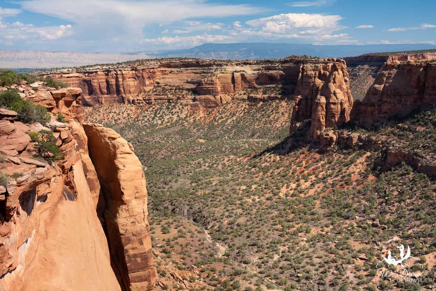
The Saddlehorn Visitor Center is well worth a stop with fascinating exhibits about the Colorado Plateau and history of the National Monument, as well as movies shown upon request.
It is open daily with the exception of Thanksgiving, Christmas Day, and New Year’s Day. The rangers here were extremely helpful in recommending trails and offering information about the monument. You can also check here for current ranger programs.

There are also three short hiking trails that start from near the Visitor Center. These include Canyon Rim Trail, Window Rock Trail, and Alcove Nature Trail.
If you have some time to spare or even want to stay overnight, you will find the campground and picnic areas here as well.
7. Book Cliffs Viewpoint
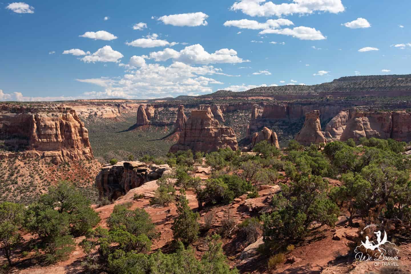
Located within the Saddlehorn area, Book Cliffs View is described as “The Heart of the World.” This term was coined by John Otto in 1907.
Looking out from this view, you’ll be able to spot some descriptively-named rock formations including the Kissing Couple, Independence Monument, The Island, Praying Hands, and the Pipe Organ.

Make sure you continue past the small pavilion and along the trail to the edge of the cliff. Just a short walk offers perhaps the best view in all of Colorado National Monument. It also connects to the Window Rock Trail and Canyon Rim Trail.
8. Independence Monument Viewpoint

While Independence Monument is visible from many different places along the highway, the named overlook provides one of the best views of it.
The isolated 450 foot (137m) sandstone tower is the largest free standing rock formation in the park. It once formed a rock wall, connecting the mesa where the viewpoint is located to the large rock formation known as “The Island” in the east.
This massive rock wall separated Wedding Canyon and Monument Canyon. Relentless erosion eventually breached the wall and parts of it collapsed, leaving the remaining monolith.
On July 4th in 1911, John Otto climbed Independence Monument to display the American flag in celebration of Independence Day. Today, Independence Monument continues to be a popular destination for rock-climbers and Otto’s 4th of July tradition has been continued to this day by local climbers.
9. Grand View

The Grand View is a fenced overlook just a short stroll from the roadside parking. It provides impressive vistas of Monument Canyon, Wedding Canyon and Grand Valley. From here, you can peer down into Monument Canyon below from atop a 300ft (91m) high cliff. Take some time to admire the various sandstone pinnacles as well.
Below the overlook is Grand View Spire, a 400ft (122m) sandstone pillar. This is another popular climbing destination, so keep a look out for climbers here!
Beside Grand View, you will see Half Tunnel Exhibit. Here you have views towards Half Tunnel, where the road is cut into the face of a sheer cliff.
While the construction of Rim Rock Drive was a major feat of engineering at the time, it also resulted in the death of a total of 11 workers. In December 1933, nine men were killed when part of the overhanging roof suddenly collapsed into their work area. Two further workers were killed in separate incidents. All of these workers are commemorated at Half Tunnel Exhibit.
10. Monument Canyon View
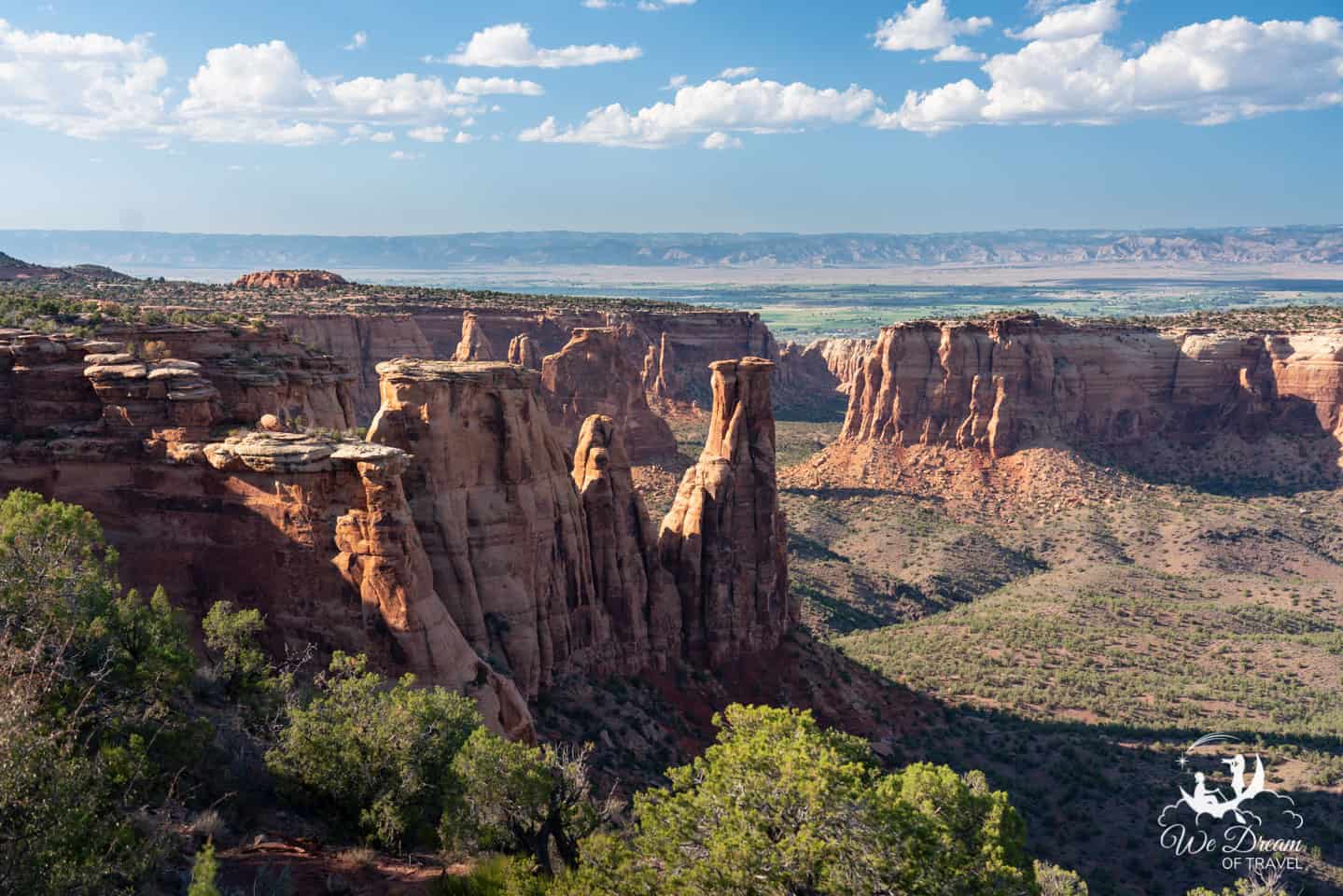
The drive between Grand View and Monument Canyon is perhaps the most picturesque stretch of road within the park. So much so that we had to go back and drive it again!
Keep your eyes peeled to the left for spectacular views out over the canyon from Rim Rock Drive before reaching Monument Canyon!
Monument Canyon is the feature attraction of Colorado National Monument and the longest of the four ravines within the park. It is within this canyon that you’ll find the most famous rock formations including Independence Monument, the Kissing Couple, and Coke Ovens, many of which you will have already spotted along the Rim Rock Drive by this point!

As with the other canyons throughout Colorado NM, Monument Canyon was formed by erosion. This has taken place through a combination of flash flooding and winter freezing and thawing cycles. These processes continue to shape the canyon today.
For keen hikers, you can explore the canyon via the Monument Canyon trail. This trail follows Monument Canyon for about 5 miles and provides close-up views of the various rock formations. It is an 11.6 miles (18.7km) out and back trail with an 1873ft (571m) elevation gain.
11. Coke Ovens Overlook

Erosion within the canyon has produced many unique formations, including the conical-shaped Coke Ovens.
Early visitors to the area named these natural structures due to their resemblance to the man-made coke ovens that were used at the time to convert coal to coke; a fuel that produces little or no gas when burned.
The rounded domes of Wingate Sandstone are what remains of previous monoliths. As these earlier monoliths lost their protective Kayenta caprock, softer sandstone was exposed and eroded into the shapes we now see.
The presence of iron and other minerals in the rocks adds a colorful array of red, orange, purple and brown to these already fascinating structures.
12. Artists Point

Just a little further along the Rim Rock Drive is Artists Point. This overlook highlights the vibrant colors visible throughout the landscape.
A combination of mineral deposits, vibrant lichens and chemical compounds add to the brightly colored rocks visible in the hills adjacent to the overlook.
13. Highland Viewpoint

Despite being one of the highest overlooks, Highland View was not our favorite viewpoint.
By this point, you’ve lost the views of the rock formations that made the other stops so fascinating. However, it does highlight the forests in the monument and the importance of woodland relationships.
As with all the viewpoints, as they require so little commitment in the way of time and energy, it’s well worth stopping at them all!
14. Upper Ute Canyon Overlook

While Upper Ute Canyon Overlook doesn’t provide the most impressive of views, it is perhaps the most fun stop along the entire Rim Rock Drive and one not to miss if you’re traveling with kids! And with that said, the view is still very pretty.
The canyon provides an impressive echo and the interpretive sign explains how to measure the distance of the canyon wall from the viewpoint using your echo. This involves shouting out into the abyss and counting the time it takes to hear your echo.
Not only is it highly entertaining, it is also educational. This exercise helps provide a great insight into how bats use echolocation to navigate.
15. Fallen Rock Overlook

Fallen Rock provides an excellent example of the geological processes that continue to shape this incredible landscape.
Across the canyon from the overlook, you’ll notice a large chunk of rock that has slid down more than 100ft (30m). This occurred over centuries and likely reached its current resting place thousands of years ago.
Freezing and thawing would have enlarged a crack between Fallen Rock and the cliffside until it eventually separated. At the same time, flash flooding and water seepage eroded the Chinle Formation below it, causing Fallen Rock to slowly slide onto the debris it now rests upon rather than toppling forward.
16. Ute Canyon Viewpoint

As you drive from Fallen Rock to Ute Canyon View, you will pass the highest point on the Rim Rock Drive at 6640ft (2024m).
Look out over sheer red cliffs contrasting against the green vegetation below and take the Ute Garden Interpretative Trail to learn more about the plants and animals living in the area, and their importance to the Ute people that lived in this area.
17. Red Canyon Overlook

Red Canyon Overlook provides unobstructed views northeast of Grand Junction, framed by red-striated cliffs. There are no trails into the canyon due to its steep walls, creating a true wilderness area.
This area is also unique as its a canyon within a canyon. At the far end of the broad U-shaped canyon is a dark V-shaped notch cut in the canyon floor. As erosion continues, this V-cut will grow longer and wider changing the shape of the canyon we can see today.
18. Cold Shivers Point

This final viewpoint overlooks the Columbus Canyon, one of the smaller canyons within Colorado National Monument.
Cold Shivers Point is perched at the edge of a 300-ft (91m) sheer cliff, allowing you to look directly down into the canyon below.
🏃♀️ Best Things to Do in Colorado National Monument
🚘 1. Drive the Colorado National Monument Scenic Drive

Easily the best thing to do in Colorado National Monument is the scenic Rim Rock Drive. As explained above, there are a myriad of overlooks that require little to no walking and allow you to take in a variety of spectacular views.
We started our drive at the west (Fruita) entrance. While you can take the drive in either direction, the views near Fruita, in our opinion, are much better so you may prefer to start the drive at the east (Grand Junction) entrance.
Completing the scenic drive in the direction of Grand Junction toward Fruita will make it easier to pull off along the way as most of the parking areas will be on your right. It also means that the views will get increasingly better as you drive through the monument.
🥾 2. Explore one of many Hiking Trails

Colorado National Monument offers a wide variety of trails for hikers of all abilities with over 45 miles of maintained trails, ranging from 0.25 miles to over 14 miles in length.
If you’re looking for a short hike, we highly recommend the Window Rock Trail, Otto’s Trail and Devil’s Kitchen Trail.
We had a full day in the monument and managed these three trails as well as all the viewpoints, spending a good chunk of time photographing each stop, as well as a long stop to photograph Bighorn Sheep along the way!
If you have the time for only one trail, I’d highly recommend the Devils Kitchen as it provides the most unique experience. While Otto’s Trail reaches perhaps one of the best viewpoints in the monument, it is just a different vantage point of formations you are already able to see from the road.
The Devils Kitchen, meanwhile, takes you to an entirely different area of the monument.
🚵♀️ 3. Bicycle the Scenic Loop
The Rim Rock Drive provides a scenic and challenging ride for road cyclists. The full loop is 33 miles long with a 2300 vertical feet aggregate climb, including the Rim Rock Drive and the roads connecting the two park entrances.
However, for those that are looking for a shorter ride avoiding the steep hills, park at the Visitor Center and ride across the monument and back. This will allow you to still see most of the best views while cutting down your cycle time substantially!
Each year, the Tour of the Moon road bike race passes through Colorado National Monument. The annual even has 2,200 participants who cycle either a 41-mile or 64-mile course.
🎒 4. Go Backpacking through the Backcountry
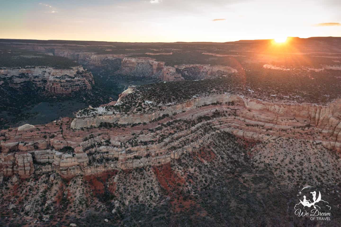
Available year-round, backpacking here is a great option! Sleep under the stars, surrounded by the smell of sagebrush after a day of exploring some of the 46 miles of backcountry trails within Colorado National Monument.
If you do plan on backpacking, ensure you get a free permit at the Visitor Center and understand the rules for backcountry camping.
🧗 5. Scale the Tower (Rock Climbing)
For many years, the sandstone cliffs and unique rock formations of Colorado National Monument have been attracting rock climbers. Today, hundreds of climbers scale the rocks each year, with the main attraction being Independence Monument.
Find out more about climbing at Colorado National Monument on their website. Here you can also find details for approved guides if you wish to take a guided climb.
📛 6. Become a Junior Ranger
You can pick up a booklet from the Visitor Center or entrance station which has a variety of activities to complete throughout your visit. Once completed, return to the Visitor Center where a ranger or volunteer will swear you in and award you with your official Junior Ranger Badge.
While it is certainly a fun activity to do with kids and despite the name, there is no age limit to the Junior Ranger Program. It is a great way to learn more about the park, regardless of age!
🦅 7. Look for Wildlife

The varied terrain in Colorado National Monument is home to a wide variety of animals, including mammals, reptiles, amphibians and birds. Mule deer are the most commonly spotted mammals. However, lucky visitors may catch sight of bighorn sheep, coyotes, cougars, bobcats, foxes, and desert cottontails.
The monument is a fantastic place for bird watching as the towering canyon walls provide the perfect place for many nesting birds. Listen for the swoosh of passing swifts below the rim, and keep your eyes peeled for golden eagles and red-tailed hawks soaring above.
During the summer months, you may spot lizards basking in the sun in the late morning or early afternoon hours. While snakes are present within the monument, sightings are uncommon. Additionally, there is also only one venomous snake, the rarely seen midget-faded rattlesnake
Despite the semi-arid environment, there are several species of frogs and toads within the canyons. Listen out for their croaks following summer thunderstorms late in the evening!


FIND MORE INSPIRATION: 101+ Dream Destinations for your Travel Bucket List
🧗 Best Hikes in Colorado National Monument
1. Window Rock Trail

This short half-mile round trip hike starts near the Book Cliffs Overlook Shelter It takes you through pinyon pines and junipers while offering spectacular views over Wedding Canyon and Monument Canyon.
At the end of the trail you will reach Window Rock Overlook. From this fenced off area, you can view Window Rock up close and personal.
2. Otto’s Trail

The trailhead for Otto’s Trail is located a mile south of the Saddlehorn Visitor Center. This easy 0.7-mile round trip hike offers some of the most beautiful panoramic views of Colorado National Monument.
From the overlook at the end of the trail, you can see many impressive rock formations including Sentinel Spire, Pipe Organ, Praying Hands, and Independence Monument.
3. Devils Kitchen

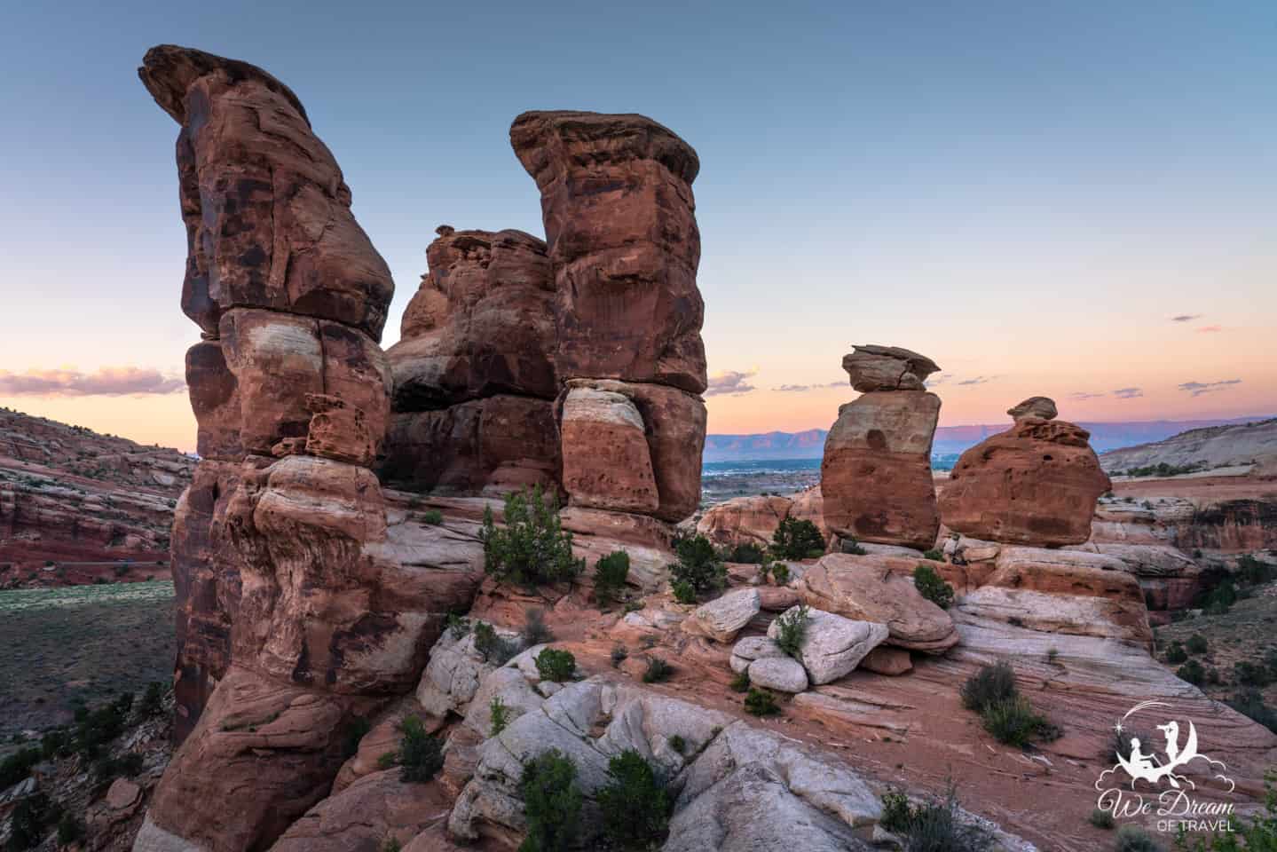
Continuing along Rim Rock Drive from Cold Shivers Point, you will traverse scenic switchbacks before reaching Devils Kitchen.
Devils Kitchen is located near the mouth of No Thoroughfare Canyon and is reached by an easy 0.7 mile (1.1km) sandy trail. This is followed by a short but steep climb up carved steps within slickrock.
Upon arrival, you’ll discover a natural rock room – a cluster of pinnacles and fins of red sandstone, against a backdrop of mountains. It’s a beautiful place to visit around sunset as golden light spills over the colorful rocks.
More short hikes in Colorado National Monument

- Canyon Rim Trail: 1 mile (1.6km) round trip. Easy.
- Alcove Nature Trail: 1 mile (1.6km) round trip. Easy.
- Coke Ovens Trail: 1 mile (1.6km) round trip. Easy.
- CCC Trail: 1.5 miles (2.4km) round trip. Moderate.
- Serpents Trail: 3.5 miles (5.6km) round trip. Steep.
Backcountry Hiking Trails
There are also a number of backcountry hikes within Colorado National Monument. Permits are not required for backcountry hikes, however, no water is available and some routes aren’t maintained so ensure you are well-prepared and have informed someone of your plans.
- Corkscrew Trail Loop: 3.3 miles (5.3 km) one way. Moderate to strenuous.
- Old Gordon Trail: 4 miles (6.4km) one way. Easy.
- Black Ridge Trail: 5.5 miles (8.8km) one way. Moderate.
- Monument Canyon Trail: 6 miles (9.7km). Moderate to steep.
- Ute Canyon Trail (unmaintained): 7 miles (11.3km). Steep.
- Liberty Cap Trail: 7 miles (11.3km). Steep at lower trailhead; easy at upper trailhead.
- No Thoroughfare Trail: 8.5 miles (13.7km). Moderate to strenuous.
Find more information on hiking trails on the NPS website.
🗺 Maps of Colorado National Monument
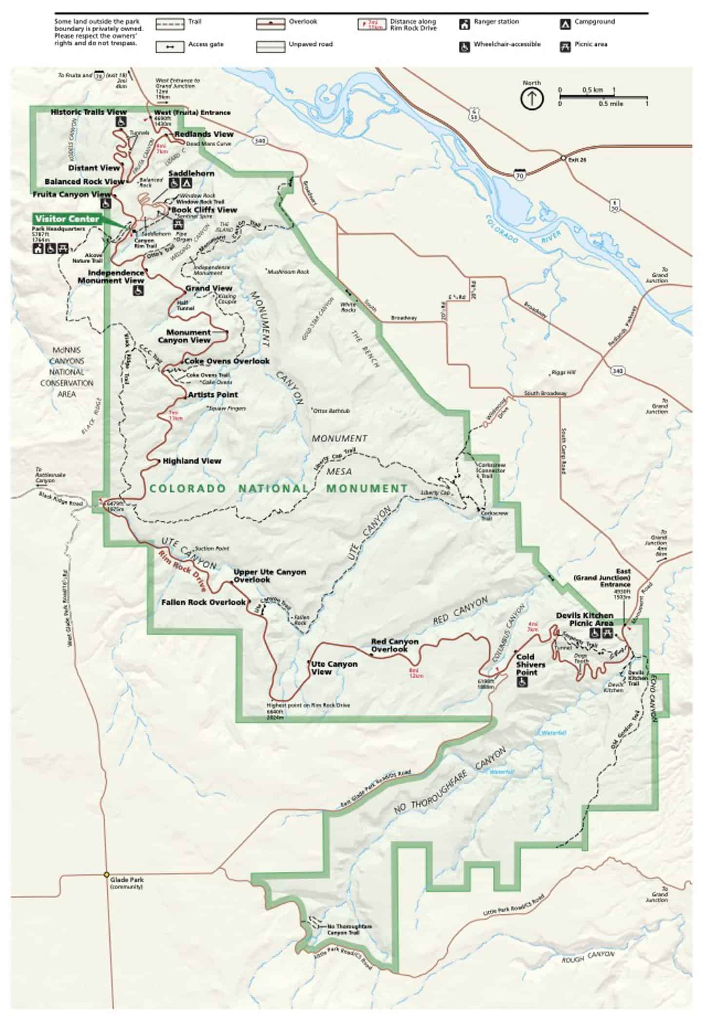
Official Colorado National Monument Map
Below is the official park map, showing the various viewpoints and trails within the park. You can find a downloadable version of this map on the NPS website.
Interactive Google Map of Colorado National Monument
We’ve also put together an interactive Google Map of Colorado National Monument. This map features all of the sights and places we mention within this blog post. Click here or on the image below to open the map in a new tab.

♥️ LOVE THE NATIONAL PARKS?
DISCOVER 65+ PERFECT NATIONAL PARK GIFTS
📝 Planning Tips for Your Visit to Colorado National Monument
Hopefully, by now you understand why you should visit Colorado National Monument! At this point, it seems important to provide some practical information to help you plan your time there and ensure you have the best possible experience.
🌅 When to Visit Colorado National Monument
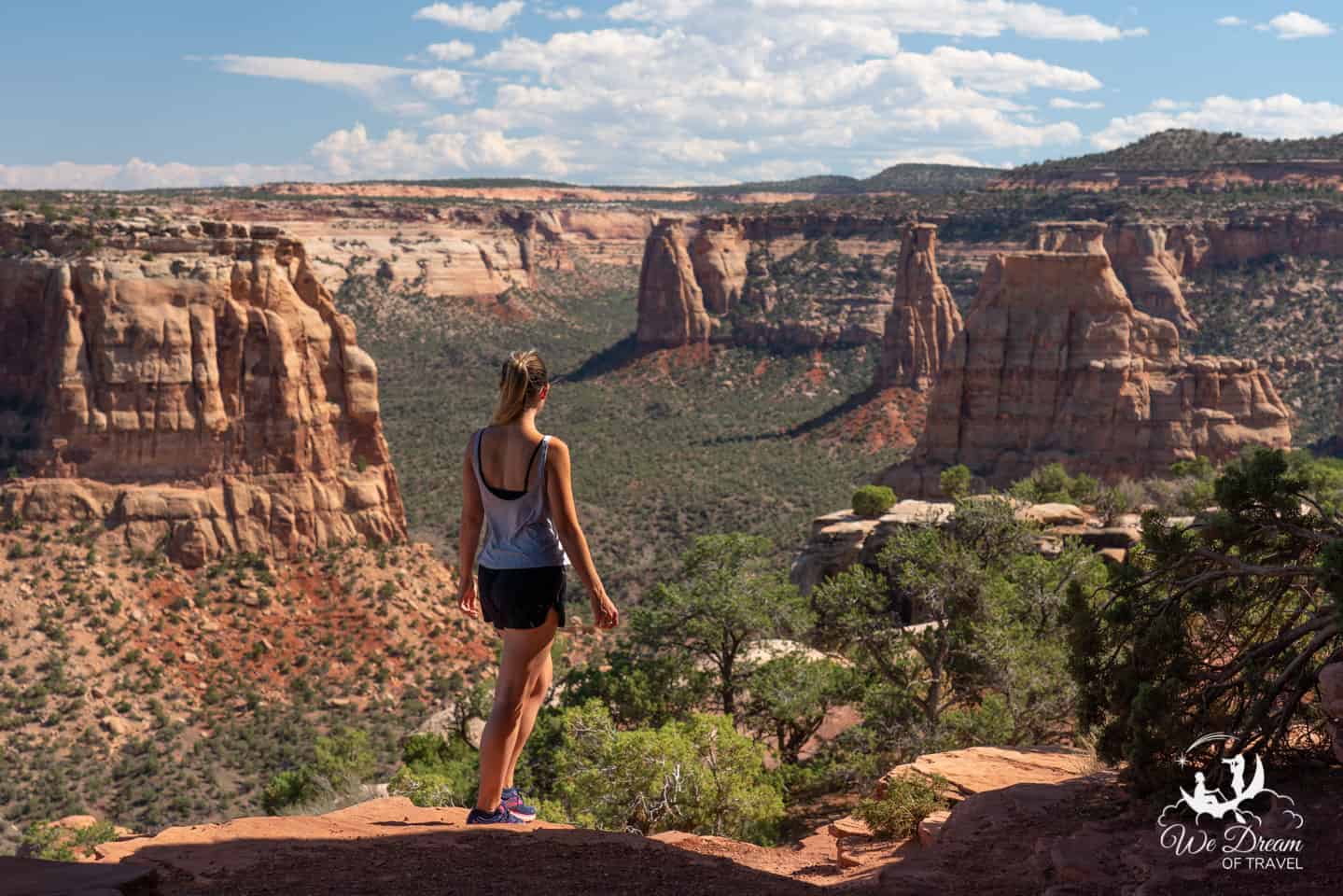
Colorado National Monument is open year-round and is well worth visiting at any time of year. It has semi-arid and upland climates, with elevations ranging from 4,000ft (1220m) to almost 7,000ft (2130m), making the temperatures widely variable.
Spring and autumn are the wettest months, however, they still typically only see 1 inch of precipitation each month. Additionally, the temperatures are mild, perhaps making spring and fall the best times of year to visit Colorado National Monument.
Summers can be very hot, with temperatures averaging 90°F+ (32°c+) in July and August. While summer may not be an ideal time for long hikes, fortunately, most of the best views require minimal hiking from the scenic drive. Therefore, a visit in the summer can still be very enjoyable.
Winters here are reasonably mild with average winter lows of around 20°F (-7°c) and average highs of 40°F (4°c). Snowfall also averages 31 inches annually, so you can expect to encounter some snow in places too!
☀️ How Many Days to Spend in Colorado NM

The scenic Rim Rock Drive is 23 miles long and takes around one hour to drive with no stops. Therefore, if you have only a few hours you can easily drive through the park and stop at most of the best viewpoints.
However, I’d recommend taking a full day to explore. This will give you ample time to stop at all of the above viewpoints, as well as to stop at the visitor center to learn about and appreciate everything you are seeing. In addition, you can end you day with a walk to Devil’s Kitchen to enjoy the sunset.
For those that wish to undertake some of the other incredible hikes, I’d recommend spending the night in Colorado National Monument or nearby to allow for two days in the park.
🚗 How to Get to Colorado National Monument

There are two entrances to Colorado National Monument: Fruita (west entrance) and Grand Junction (east entrance). The Saddlehorn Visitor Center is located closer to the Fruita entrance, just over 4 miles (10 minutes) from the beginning of the Rim Rock Drive.
The entrance you start at will be most likely determined by which direction you are traveling from. If coming from the east, you will want to begin your journey through Colorado National Monument at Grand Junction Entrance, and from the west, you will enter at the Fruita entrance.
However, if you are considering a loop, you may wish to start at Grand Junction. Most of the pull-offs for viewpoints will be on your right in this direction, making it easier to stop. Additionally, as we previously mentioned, we found the viewpoints near the Fruita entrance far more scenic. Therefore, by starting at Grand Junction your views just continue to get better!
There are no public transport options for getting to Colorado National Monument. Therefore, you will need your own transportation to get here.
⛽️ Gas, Food, and Supplies Near Colorado NM
There are no restaurants or gas stations within Colorado National Monument, however, both can be found nearby either in Fruita or Grand Junction.
The Visitor Center has drinking water available, as well as some snacks such as granola bars and cookies. However, no other food is available so ensure you plan accordingly.
🏨 Where to Stay in Colorado National Monument

Accommodation
There are no hotel or lodging options within the park. If you wish to stay within the park, then the only option is camping.
Camping
Saddlehorn Campground is the only established campground within Colorado National Monument. It is located near the Saddlehorn Visitor Center, four miles from the Fruita (west) entrance and 19 miles from the Grand Junction (east) entrance.
The campground has 80 sites within three loops (Loops A, B and C). These sites accommodate RVs, campers, trailers, and tents. Loop A is open year-round and first-come-first-serve from mid-Oct to mid-March, while Loops B and C are only open seasonally.
Restrooms have flush toilets and water available during the summer, and each campsite has a picnic table and charcoal-only grill. There are no electric hookups or showers, and wood fires are not permitted anywhere in the monument.
Sites cost $22 per night, in addition to the park entrance fee.
Where to Stay Outside Colorado National Monument
For nearby accommodation, you can choose to stay at Fruita or Grand Junction, both of which have several options for lodging, although you’ll find a wider variety in Grand Junction.
😃 Fun Facts About Colorado National Monument

- John Otto adopted the canyon as his home in 1906 and subsequently spearheaded the campaign to have his “backyard” declared a national park. When the park was declared a National Monument in 1911, John Otto became the first park custodian.
- There are three tunnels along the Rim Rock Drive, of which the longest is 530ft (162m) long.
- The Coors Classic Tour of the Moon international bike race brought fame Colorado National Monument during the 1980s.
- The monument receives less than 12 inches of rain per year.
- Rocks at the foundation of Colorado National Monument date back to nearly 1.7 billion years ago.
- Its sheer walled canyons reach depths of 500ft and have rock monoliths as tall as 450ft.
- Colorado National Monument is one of thirteen National Park Service (NPS) sites in Colorado.
🙋 FAQs About Colorado National Monument

Why is it called Colorado National Monument?
Colorado National Monument is named after the Colorado River that runs through its canyons. It is one of eight national monuments in the state of Colorado.
Is Colorado National Monument worth visiting?
Colorado National Monument is absolutely worth visiting if you are driving through the area, but may not be worth a significant detour. There are plenty of spectacular red rock landscapes, deep canyons, and towering sandstone monolith to enjoy.
How long does it take to drive through Colorado National Monument?
The drive from one entrance of Grand Canyon NM to the other via the Rim Rock Drive takes just under one hour without stops. Most visitors require 2-3 hours to complete the drive with stops.
Where do I enter Colorado National Monument?
There are two entrances to Colorado National Monument: Fruita (west) entrance and Grand Junction (east) entrance. The 23-mile scenic Rim Rock Drive connects the two. You can begin your adventure through this beautiful park at either entrance.
Are dogs allowed at Colorado National Monument?
Yes, dogs are allowed within Colorado National Monument. However, they must remain on a leash and can only go on paved roads. They are not permitted on any of the hiking trails or anywhere in the backcountry.
What are the 8 National Monuments in Colorado?
The 8 National Monuments in Colorado include Browns Canyon, Canyons of the Ancients, Chimney Rock, Colorado National Monument, Dinosaur, Florissant Fossil Beds, Hovenweep, and Yucca House.
Additionally, there are 4 National Parks: Black Canyon of the Gunnison, Rocky Mountain, Mesa Verde, and Great Sand Dunes.
⛰ More Colorado & Southwest Travel Guides


The two of us work very hard to create these free travel guides to help you plan your dream vacation. If you think we’ve done a good job and would like to say thanks, please consider clicking the donate button below 🙂
For many of you reading, your visit to Colorado National Monument will be part of a greater American Southwest adventure. If you enjoyed the photos and descriptions of this guide, browse our other regional blogs and National Park guides for further inspiration and information:
COLORADO GUIDES
- Ultimate Guide to All 12 National Parks & Monuments of Colorado
- Black Canyon of the Gunnison National Park Complete Guide
UTAH, ARIZONA, & SOUTHWEST GUIDES
- Bryce Canyon to Zion National Park Road Trip Guide
- Ultimate Guide to the 50 Best Utah Slots Canyons
- 50 Most Beautiful Canyons in the US
- One Day in the Grand Canyon Itinerary
- Grand Canyon Photography Guide
- Grand Canyon North Rim Complete Guide
- White Sand National Park Photography Guide
💬 Final Thoughts on Visiting Colorado National Monument
The two of us work very hard to create these free travel guides to help you plan your dream vacation. If you think we’ve done a good job and would like to say thanks, please consider clicking the donate button below 🙂
We truly hope you have found this complete guide to visiting Colorado National Monument helpful in planning your first visit to the park.
Now we’d like to hear from YOU!
Was there anything confusing, inaccurate, or missing that you would like to see? Was it everything you hoped for and more?
Help us help others by leaving a comment below!
📌 Enjoyed this guide to Colorado National Monument? Pin it! 🙂
Because sharing is caring…


