

No stretch of road in Southern Utah provides more must-see destinations than the scenic highways connecting Bryce Canyon to Zion National Park.
Travelers hoping to experience the Mighty Five National Parks of Utah will quickly learn there is enough to see in-between these destinations to merit an extra few days on their road trip itinerary.
In this guide, you will discover all the incredible destinations and unique desert landscapes of the American Southwest that are tucked away along scenic highways 12 and 89 that connect Bryce Canyon NP to Zion NP.
In addition, we will also provide a short detour option to one of the most overlooked treasures of the region: Cedar Breaks National Monument.
**If you’re planning on traveling in the opposite direction, check our Zion to Bryce Canyon guide as we’ve already reversed the order for you!
Bryce Canyon to Zion FAQs

Most travelers have the same questions regarding the journey from Bryce Canyon to Zion. This section quickly covers these frequently asked questions.
How long is the drive from Bryce Canyon to Zion National Park?
It is a 75-mile drive from the exit gate of Bryce Canyon National Park to the East Entrance of Zion National Park. Without stops, the drive takes about 1 hour and 22 minutes.
To get to the more popular west section of Zion, you have to pass through Carmel Tunnel. From Bryce Canyon, it is a total of 85 miles to the Zion Visitor Center and takes about 1 hour and 50 minutes without stops.
Can you do Bryce Canyon and Zion in one day?
Bryce Canyon and Zion NP are only about 75 miles apart, making it is possible to visit both in one day. This does not provide any time for hiking or sightseeing, however, and is not recommended.
Not only will your day be very fast-paced, making it difficult to truly enjoy the parks, but you will also miss all the incredible stops between Bryce Canyon and Zion.
What are the best things to do between Bryce Canyon and Zion NP?


The best things to do on the scenic drive from Bryce Canyon to Zion NP are:
- Cedar Breaks National Monument
- Red Hollow Slot Canyon
- Dixie National Forest
- Belly of the Dragon
- Moqui Caves
You will find the complete list of the 21 best stops between Zion and Bryce Canyon in this guide.
Where can I find services between Bryce Canyon and Zion?
You will find gas, groceries, accommodation, and restaurants at Carmel Junction, Orderville, Hatch, and at Bryce Canyon Village.
Additionally, those who make the detour to Cedar Breaks National Monument will find small towns with all the necessary amenities at Brian Head and Panguitch.
However, food is expensive in these towns so it’s well worth packing your favorite road trip food in advance!

How much does it cost to enter Bryce Canyon and Zion?
Weekly passes for Bryce Canyon and Zion cost $35 per vehicle for each individual park, for a total of $70 for the two parks combined.
♥️ LOVE THE NATIONAL PARKS?
DISCOVER 65+ PERFECT NATIONAL PARK GIFTS
Map of Bryce Canyon to Zion road Trip Stops

This interactive map above shows where each of the featured stops between Bryce Canyon NP and Zion are located.
All points can be accessed with standard 2WD vehicles, though some roads may be impassable following flash flooding.
Before reading about each stop, it may be helpful to first orient yourself with the map above.
Click here or on the image below to open the Google Map.
Bryce Canyon to Zion Itinerary

Unless you are trying to visit both national parks in a weekend, there is too much to see and do between Bryce Canyon and Zion to simply drive from one to the next.
Along the way, you will discover some incredible attractions ranging from famous wonders to hidden gems.
If possible, allow at least 1-2 days for the journey so that you do not miss any of the lesser-known treasures along the way.
In this section, you will find all of the best stops in the order in which you will pass them.
Note that Stops 4-9 are part of a detour to Dixie National Forest and should be skipped if time is short.
1. Utah Scenic Byway 12

Perhaps the most impressive highway in all of Utah is Scenic Byway 12. You will begin your journey to Zion from Bryce Canyon along this impressive stretch of road and will rarely be afforded a chance to catch your breath.
As soon as you reach the roundabout outside of Bryce Canyon Village, you will begin a short scenic stretch of Highway 12.
Time and interest permitting, there are a handful of hikes and roadside attractions to see along the way before turning south onto Hwy 89.
2. Red Canyon

Most visitors drive right past Red Canyon without realizing how many amazing trails and sights they are missing.
You can see plenty right out the car window. If you have time for a hike, however, stop by the Red Canyon visitor center on the way. Here you can find a list of all available trails, a few of which begin right in that very parking lot!
We can personally recommend a few short hikes that provide spectacular views of the Mars-like canyon. These include Photo Trail, Tunnel Trail, Golden Wall Trail, and Pink Ledges Trail.
3. Losee Canyon & Arches Trail
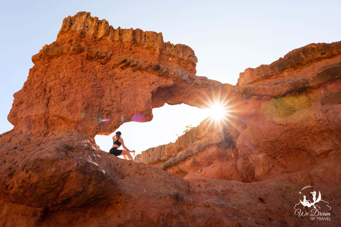
Just a mile after leaving Red Rock Canyon, you will find a dirt road on your right that leads to Losee Canyon. There are several beautiful hikes available in Losee Canyon, but the one you absolutely should not miss is the Arches Trail.
The Losee Canyon trailhead is located a couple of miles up a dirt road. It is easily found on Google Maps and can be accessed with standard 2WD vehicles.
Upon arriving at the trailhead, you will see signs for many hikes but NOT Arches Trail!
After parking, find the trail information board, then look to your left for a small paper sign that just has the words “Arches Trail” typed on it.
You will have to scramble into the wash from here but should have no trouble finding and staying on the trail. The entire walk is less than a mile in total, with the Arches Trail loop itself totaling about half a mile.
4. Dixie National Forest (Detour)
Total Detour: 1h 15m, 50 miles

Scenic Byway 12 will end at the junction of Highway 89. The most direct drive to Zion NP from here is to turn south toward Mount Carmel Junction.
However, those with the time and interest should consider a short detour into Dixie National Forest. This can be done as a quick loop by turning RIGHT at the Hwy 89 junction (headed toward Panguitch).
Explorers will discover a wild beauty here completely different to much of the surrounding regions. Expect to pass by pristine alpine lakes, waterfalls, and even some caves.
The biggest reason to consider the Dixie National Forest detour, however, is to visit Cedar Breaks National Monument.
5. Panguitch Lake Resort (Detour)

At no cost to you, we receive a small amount for any bookings made using the links below.
*This stop is located along the Dixie National Forest loop detour.
On your way around the scenic loop, you will immediately pass through the resort town of Panguitch. You will also pass a beautiful lake with the same name.
If the alpine-town charm appeals to you, Panguitch is a great place to stay overnight, Otherwise, simply enjoy its beauty from the driver’s seat as you pass on through.
6. Cedar Breaks National Monument (Detour)

*This stop is located along the Dixie National Forest loop detour.
Cedar Breaks National Monument is the main reason to consider a detour through Dixie National Forest on your way to Zion from Bryce Canyon.
While it is difficult to label any National Monument a “hidden gem”, Cedar Breaks is certainly one of the most overlooked highlights in the region!
After seeing Bryce Canyon National Park, you may not be quite as impressed at first glance. Both provide similar hoodoo-filled amphitheaters and unique color palettes, but Cedar Breaks is much smaller with no hiking access to the hoodoos.
Unlike Bryce Canyon National Park, however, Cedar Breaks is never very busy. Additionally, the vistas from the viewpoints at Cedar Breaks are far better for sunset photography than they are at Bryce, which is best at sunrise. Both are spectacular places for stargazing.
The other feature Cedar Breaks can offer that Bryce Canyon does not is a collection of ancient bristlecone pine that make for intriguing subjects in the foreground of your photos.
7-9. Navajo Lake, Duck Lake, & Aspen-Mirror Lake (Detours)

*These stops are located along the Dixie National Forest loop detour.
After leaving Cedar Breaks NM, you will begin to descend in elevation slightly before happening upon a series of scenic alpine lakes.
The first of these is Navajo Lake, which can be seen from an overlook or driven to, if desired. The next will be Duck Lake and Aspen-Mirror Lake.
Both of these are located near the town of Duck Creek and are favorites for everyone from landscape photographers to anglers to picnickers. If possible, plan an overnight visit to wake up to a perfect mirror-reflection of sunrise at Aspen-Mirror Lake.
Also Nearby: Duck Creek Ice Cave and Cascade Falls.
10. Mount Carmel Junction
Whether you have elected to take the detour to Dixie National Forest or chosen the direct route, you will inevitably end up back on Highway 89 headed south toward Mount Carmel Junction and Zion National Park.
The small town of Mt Carmel has a couple of fuel stations, restaurants, a golf course, and a handful of beautiful landscape destinations nearby.
11. Red Hollow Slot Canyon
Drive Distance: 7 minutes, 5 miles north of Mount Carmel Junction
Hike Distance: 2 miles roundtrip

The first short detour after turning back onto Hwy 89 will be a stop at Red Hollow Slot Canyon near the town of Orderville.
“Slot Canyons” do not exist in many places on Earth outside the American Southwest, so we try to see as many of these as we can. The great thing about Red Hollow is that it does not require canyoneering equipment.
Google Maps should get you to the right trailhead. From there, the easiest way to find the slot canyon is to always stay left.
If you are as fascinated as we are by these natural marvels, check out our comprehensive guide to the best Utah Slot Canyons.
Orderville Slot Canyon Tours
If you want to add a little extra adventure to your Bryce Canyon to Zion itinerary, consider a tour of some of the other spectacular slots canyons in the area.
Both of these tours begin in Orderville and are a great way to discover more of the beauty of the Southwest.
Take a thrilling UTV ride followed by a stunning hike in a slot canyon on this Slot Canyon Exploration and UTV Tour.
Alternatively, if you want to give canyoneering a try, this Rappelling Slot Canyon & UTV Tour will take you on a rappelling adventure by UTV. No experience is necessary and the tour has drops for every skill level, even those with no prior rappelling experience.
12. Belly of the Dragon
Drive Distance: 2 minutes, 1 mile from Mount Carmel Junction
Hike Distance: <1 minute

The Belly of the Dragon tunnel was constructed to be a water drainage for Highway 89. Nowadays, it is a popular stop for visitors of all ages on the way to Zion from Bryce Canyon.
The parking area is located just a mile from Carmel Junction.
Unless you are claustrophobic, there is no reason to skip this hidden gem as there are no entry fees or long hikes required.
13. Elkheart Slot Canyons (Huntress Canyon)
Drive Distance: 4 minutes, 3 miles from Mount Carmel Junction
Hike Distance: 1-5 miles roundtrip, depending on desired distance.

The Elkheart Slot Canyons are a semi-technical series of slot canyons. This means some equipment is required for certain sections.
Be aware that they are also known as the Huntress Slot Canyons and sometimes misnomered as Diana’s Throne. However, Diana’s Throne is actually a feature within the canyon.
If you use Google Maps to find the Elkheart Slot Canyons trailhead, it will accurately deliver you to a large dirt parking lot. There are no signs or markings, just a dirt lot located on a sharp corner of the road.
From here, you will find a dirt road with tire tracks. However, only ATVs and 4WD vehicles should attempt this stretch. Most of you will instead need to walk this section by foot.
After a quarter mile, you will encounter telephone wires that intersect the path. Local guides know the fastest route, but there is no way to identify it otherwise. Instead, follow any of the unmarked trails toward the canyon wall until you arrive at the wash.
The slot canyons are located throughout this wash in both directions.
14. Moqui Cave
Drive Distance: 11 minutes, 11 miles from Mount Carmel Junction
Hike Distance: N/A

The Moqui Cave is a historic roadside attraction that has been managed and preserved by the Chamberlain family for generations.
It has a kitschy curiosity that will intrigue most, but is not much for photographers.
History buffs and culture enthusiasts, however, can take a tour of the cave to learn about the Paiute tribe that once called Moqui Cave home while discovering many ancient artifacts.
15. Hwy 89 Sand Caves
Drive Distance: 12 minutes, 11.5 miles from Mount Carmel Junction
Hike Distance: Very challenging 0.5 mile roundtrip (but can be seen from the road)
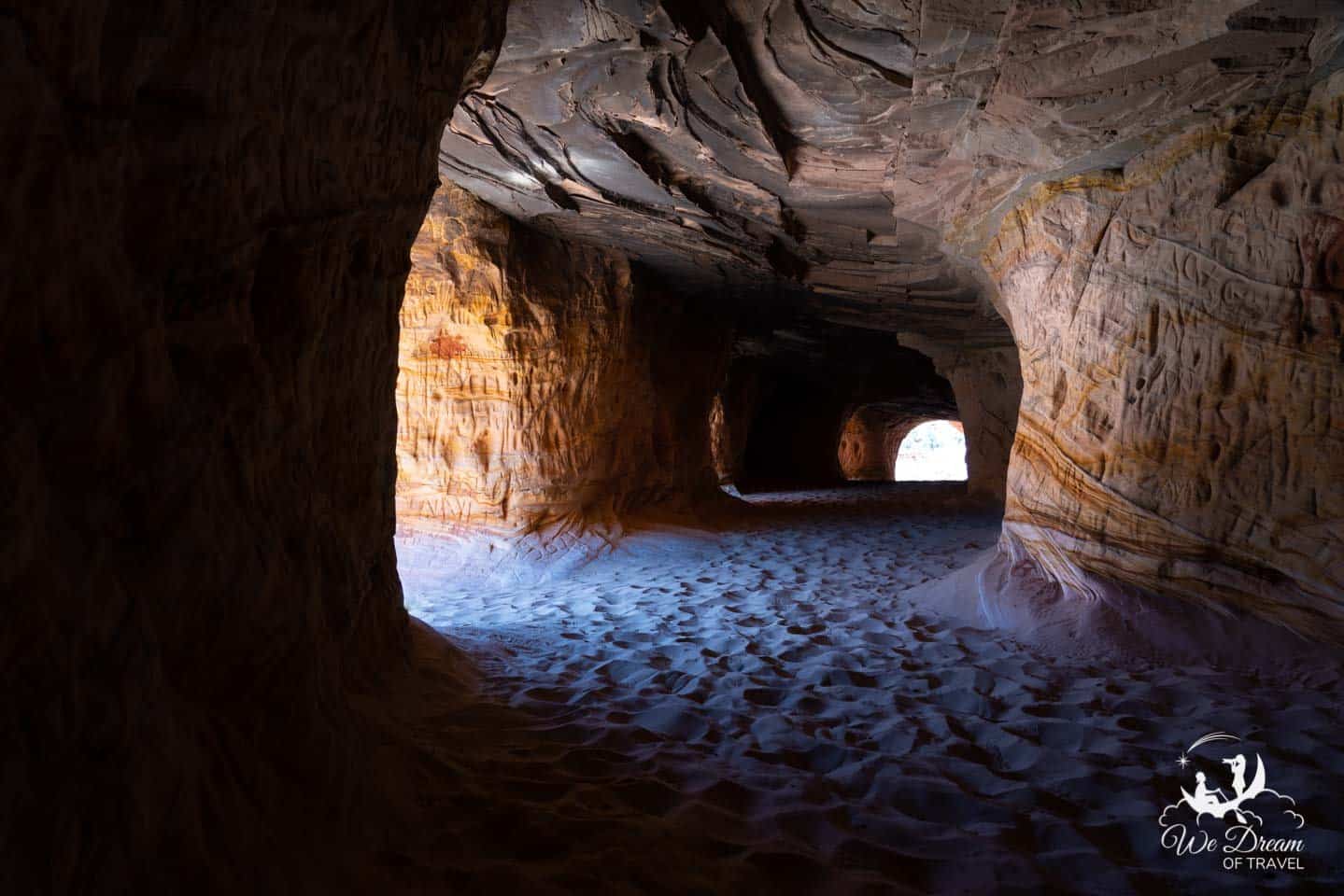
Drive 1/4 mile beyond Moqui Cave and look to your left. There, you will see a few small holes in the rock high up on the cliff. To the right, find the unmarked parking area. Park here then cross the road to where the trailhead to these hidden sand caves begins.
The entire hike to the sand caves is only half a mile roundtrip, maybe less, but is very difficult. It begins on a sand track that is easy enough. Soon enough, it dead-ends at a steep cliff wall where you will have to scramble over slick rock and climb toward the caves.
This should only be attempted with proper footwear and by people with good physical ability. The risk of slip and falls is high and could easily result in broken bones or worse. It’s not all doom and gloom, however!
Most young and able hikers with proper shoes will be capable of making the climb, just take your time.
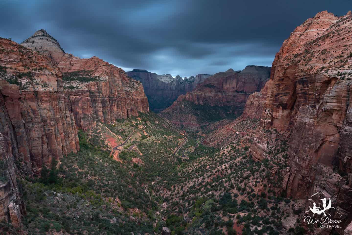
16. Mt Carmel Highway 9 – Zion Entrance
From Carmel Junction, turn right onto Highway 9 to begin the final leg of the drive into Zion National Park from Bryce Canyon.
The Zion National Park East Entrance is located 13 miles from Carmel Junction. This is the beginning of scenic Mt Carmel Highway, which hides many unsigned wonders.
Most visitors will blow by the majority of the stops listed in this guide as they are not found on the official national park map.
17. Checkerboard Mesa

Checkerboard Mesa is on the visitor map for Zion and is impossible to miss as you drive toward the Zion valley.
Parking is ample and no hike is required, but it is unlikely to hold your attention for more than a couple minutes. Though this is one of the only official stops along the way, it is far from the most impressive.
18. Keyhole Canyon

It is not possible to access the depths of Keyhole Canyon without a permit and equipment. However, you can walk to the entrance very easily and even explore it a bit from the top looking down.
Keyhole Canyon is on Google Maps and easy to find, but is not marked.
19. Zion Little Lonely Tree

This hidden gem is becoming a favorite with photographers, although is possibly not quite as interesting for the casual viewer. Like many stops on the way from Bryce to Zion, you won’t find it on the map.
To discover it, you will need to keep your eyes peeled on the left-hand side of the road between Keyhole Canyon and Many Pools.
The parking area is not signed, but is just a small pull-off.
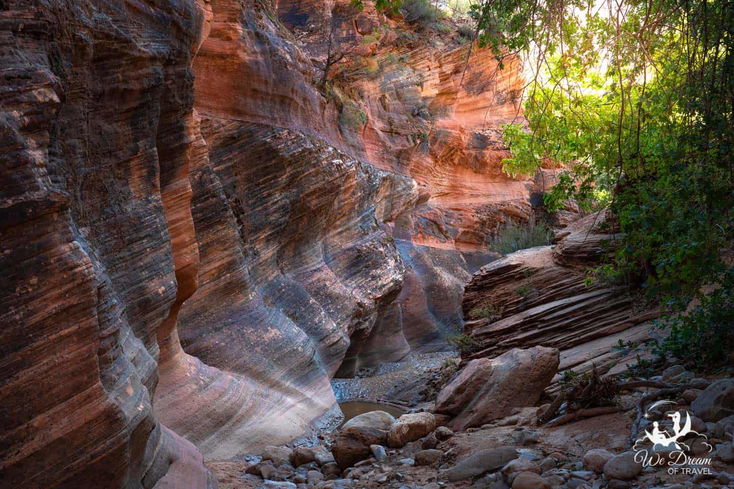
20. Pine Creek Slot Canyons

First, understand that there is one official “Pine Creek Gorge Slot Canyon”.
This is a technical slot canyon that you can only enter by repelling near the Zion Canyon Overlook Trail. Unless you have the skills, expertise, and permit, most of the official Pine Creek Gorge slot canyon will not be accessible.
Fortunately, there are a collection of other, smaller slot canyons located along the Pine Creek wash that can easily be explored by foot. The majority of these are unnamed and have no trail indicators, which makes it more fun.
As you continue the drive along Mt Carmel Highway 9 toward the western half of Zion NP, keep your eyes peeled for cracks in the canyon walls in the distance and for unmarked pull-offs.
Whenever you think you see one, hike the creek wash and you will likely discover one! In total, we discovered 5-6 slot canyons that had no names, signs, or mentions.
21. Many Pools Slot Canyons
You will not find Many Pools on the Zion National Park map, but you will find it on Google Maps.
The only indicator you are in the right place is the vault toilet and a large parking area.
Located within a quarter mile of the parking area are two slot canyons; one “true” slot and one small but colorful slot canyon.
The easiest way to find them is to look for the massive crack in the canyon wall that is visible from the parking lot, then simply take any of the unmarked trails in that direction.
You will hit the Pine Creek Wash and find the small entrance easily enough. The smaller canyon is located just to the right of this large slot.
22. Zion Canyon Overlook Trail
The last stop we will mention before going through the Carmel Tunnel and arriving in the Zion Valley is the scenic Overlook Trail.
Be aware that parking is extremely limited all times of day. Additionally, parking is only available in the lot for compact cars. If your vehicle is larger you will need to find space in one of the pull-offs.
The hike is only one mile roundtrip, so with a bit of patience you may be able to snag a spot as someone returns from their hike.
Despite the short distance, the Zion Canyon Overlook Trail is rated moderate and takes most people at least an hour to complete. There is a significant elevation gain and the trail is a bit precarious at times.
More Southwest Travel Guides


The two of us work very hard to create these free travel guides to help you plan your dream vacation. If you think we’ve done a good job and would like to say thanks, please consider clicking the donate button below 🙂
If you have found this guide useful for your journey to Zion from Bryce Canyon, you will also want to queue up some of our other American Southwest guides.
These have been created to inspire your journey and ensure you do not miss any scenic destinations while you are in the region.
- Utah Slot Canyons Comprehensive Guide
- Top 50 Canyons in the US
- Things to do in St George, Utah
- Snow Canyon State Park Guide
- Grand Canyon Photography Guide
- Grand Canyon North Rim Comprehensive Guide
- One Day in Grand Canyon Itinerary
- Things to do in Page, Arizona
- Ultimate Guide to Red Rock Canyon, Las Vegas
Final Thoughts on Driving from Bryce Canyon to Zion NP

The two of us work very hard to create these free travel guides to help you plan your dream vacation. If you think we’ve done a good job and would like to say thanks, please consider clicking the donate button below 🙂
We hope you have found this road trip guide on the Bryce Canyon to Zion drive inspiring, helpful, and informative. If you have, please let us know in the comments below!
Alternatively, we also recognize that we are not perfect and sometimes make mistakes. If you have found anything inaccurate or out of date, help us help future readers by providing constructive feedback below. It is genuinely appreciated!
Enjoyed this road trip guide from Bryce Canyon to Zion National Park? Pin it! 🙂
Because sharing is caring…


This is on our “potential trip” list for 2022! Thanks for all the info!!
Ooh I hope you make it! It’s definitely well worth it 🙂
I gotta say, Anerica’s southwest looks pretty freaking amazing. I’ll keep this guide in mind if I ever make it there.
It truly is an incredible part of the world! I hope you make it one day 🙂
When I visit the Zion Visitor Center website it sounds like the road is being closed from March to November for vehicles and only the bus is allowed. So is it still possible to drive from Bryce to Zion as described?
Sorry for the late reply Martin; YES, it is always possible to drive THROUGH the park as presented in our guide. In fact, we visited in September so the shuttle system was in place and had no issues. It is only one section of the park that requires shuttle 🙂
Thank you for this guide! It was so helpful. We did 2 nights in Bryce Canyon area and 2 nights in Zion. We LOVED the red canyon area you recommended. Your guide helped us have a great trip. ❤️🧳
Hi Rebecca! Thank you so much for taking the time to come back and leave us a comment – we truly appreciate it and LOVE hearing that you had such a great trip. We’re so happy that our guide helped you to have a wonderful time. Wishing you the best for future travels too 🙂
Hi! We are traveling with our dog and are trying to find dog friendly sights and hikes outside of the parks. Do you know if most of the activities you have listed between the two parks are dog friendly?
Hi Sarah!
How fun that you’re traveling with your dog.
As we didn’t travel with a dog, we don’t have first-hand experience with this. However, based on a little research it seems that dogs are permitted at most of the sites around Carmel Junction and outside of the National Parks. Here are a few resources to help you, along with direct quotes:
Dixie National Forest:
“Yes, dogs are welcome on the Dixie National Forest. For safety, all dogs must be on a leash in all campgrounds, picnic areas and trailheads at all times.”
Bryce Canyon NP:
“Pets are only allowed on paved surfaces, including park roads and campgrounds, the Shared-use Path, paved viewpoints (all viewpoints except Piracy Point), and the 1/2 mile (0.8 km) section of Rim Trail between Sunset and Sunrise Points.”
Zion NP:
“The only trail that allows pets is the Pa’rus Trail, which begins at the Zion Canyon Visitor Center.”
I hope this helps and you have a wonderful visit with your four-legged friend 🙂
My husband and I are heading out in October. He has limited mobility and walks with a walker, can you recommend any short paved trails between Bryce and Zion.
There are viewpoints at Cedar Breaks National Monument that require no hiking whatsoever and it is a beautiful spot! Also many of the lake stops around the loop described in the guide can be done with minimal walking. Unfortunately, most of that area requires a bit more hiking on unpaved trails – such is the way of the desert!
Have fun!